
Extension's Arizona Meteorological Network feeds data into National Weather Service
The information is valuable to agriculture, public safety and urban planners and even contributes to the weather app on your phone.
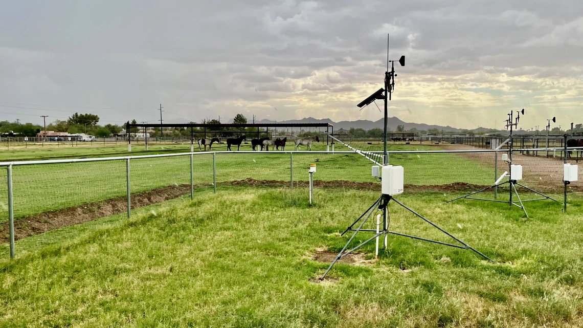
This group of sensors at the University of Arizona Campus Agricultural Center automatically collects weather data every 15 minutes. It's part of Cooperative Extension's Arizona Meteorological Network.
Brad Poole, Cooperative Extension
If you reach for a weather app to track monsoon storms, odds are good you’re looking at University of Arizona Cooperative Extension science in action.
Extension’s Arizona Meteorological Network, an array of weather stations stretching across the southern half of Arizona, feeds data into a pool captured by the National Oceanographic and Atmospheric Administration, said AZMet Program Manager Jeremy Weiss.
“They grab it, and it goes into their national database and is available for weather forecasting,” Weiss said.
The Extension data eventually becomes part of neighborhood-level weather maps on your phone. This highly granular data is especially valuable in short-term forecasting used in public safety, said Mike Crimmins, an Extension climate specialist and professor in the Department of Environmental Science.
“The Weather Service forecasts might be picking up on conditions that will lead to widespread, severe monsoon storms,” Crimmins said. “Then the day that's actually supposed to happen, the Weather Service is probably running some of these regional models to have the most up-to-date, accurate forecasts.”
AZMet started collecting data January 1, 1987. The network now has 33 solar-powered stations, each measuring air and soil temperature, precipitation, humidity, solar radiation and wind speed and direction.
Three years ago AZMet joined the National Mesonet Program. This collaboration of public, private and academic partners funnels weather data from hundreds of groups like AZMet up to NOAA, which helps fund the weather stations, Weiss said.
There are three basic groups that use the Extension network’s data – agriculture, public safety and urban governments, he said.
People working with livestock use the information to track growing conditions for alfalfa or other forage. Cotton growers closely track heat stress via AZMet, and vineyards and other growers track different aspects of temperature like heat units, chill hours and time below freezing, important metrics whether you’re growing grapes, spinach or fruit trees.
“If you're growing leafy vegetables, you may be concerned about the duration, for example, that temperature has been below a certain threshold, whether it's 32 degrees, a light freeze, or 28 degrees, a hard freeze,” Weiss said.
Current wind conditions are important for growers, because regulations don’t allow spraying of certain chemicals in high winds, he said.
The City of Phoenix, Town of Payson and homeowners in both places use network weather stations to help determine turf water needs, and firefighters use the high-resolution forecasts to keep track of conditions – wind, temperature and humidity – on the ground during wildfires.
Extension data contributes to two types of forecasts – numerical and statistical. Numerical models predict short-term weather, like what’s going to happen this afternoon. Statistical models forecast patterns on a much broader scale and help predict whether spring will be wetter or drier than normal.
“Those models are coarser, because we can't definitively say, there's going to be 2 inches of rain by July 25th at a particular spot at that time scale. It’s more like, ‘Statistically there's a better chance of it being wetter than drier,’” Crimmins said.
Crimmins uses statistical models to help stakeholders, including farmers and ranchers, predict what’s going to happen on a broad scale – weeks or months in advance.
As for the 2025 monsoon forecast, when the season started June 15 the forecast was … up in the air. The seasonal models were calling for equal chances of below average, average and above average rainfall, Crimmins said.
“So if you want to be optimistic, then that opens up the opportunity for average to above average precipitation. I think that's the way the whole monsoon is going to go. You're going to have to look out the window,” he said.